News

Pickett acquires SkyFish M4 UAS

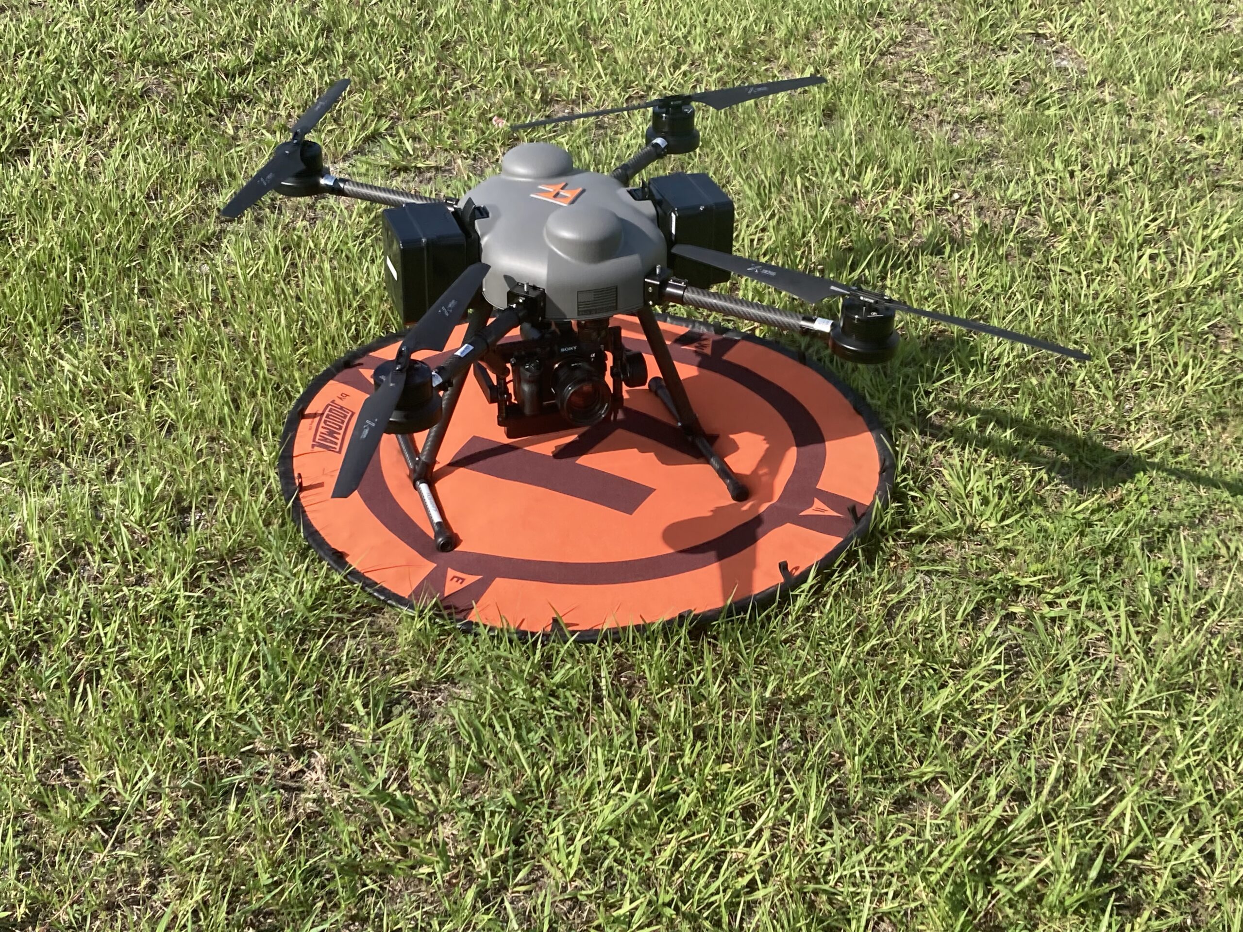
Pickett is pleased to announce the purchase of a new SkyFish M4 RTK aircraft! This USA-made system is an innovative addition to our existing Unmanned Aerial System (UAS) fleet. The…
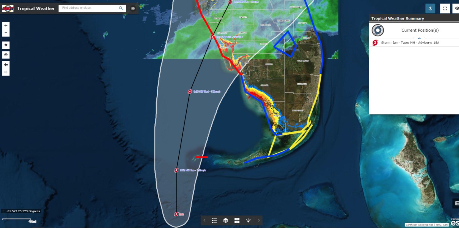
Now Open In Hendersonville, NC!

Pickett is pleased to share the opening of a new office in Hendersonville, North Carolina! This is especially exciting as it is the first space that Pickett has shared with…

Pickett Expands Fleet!

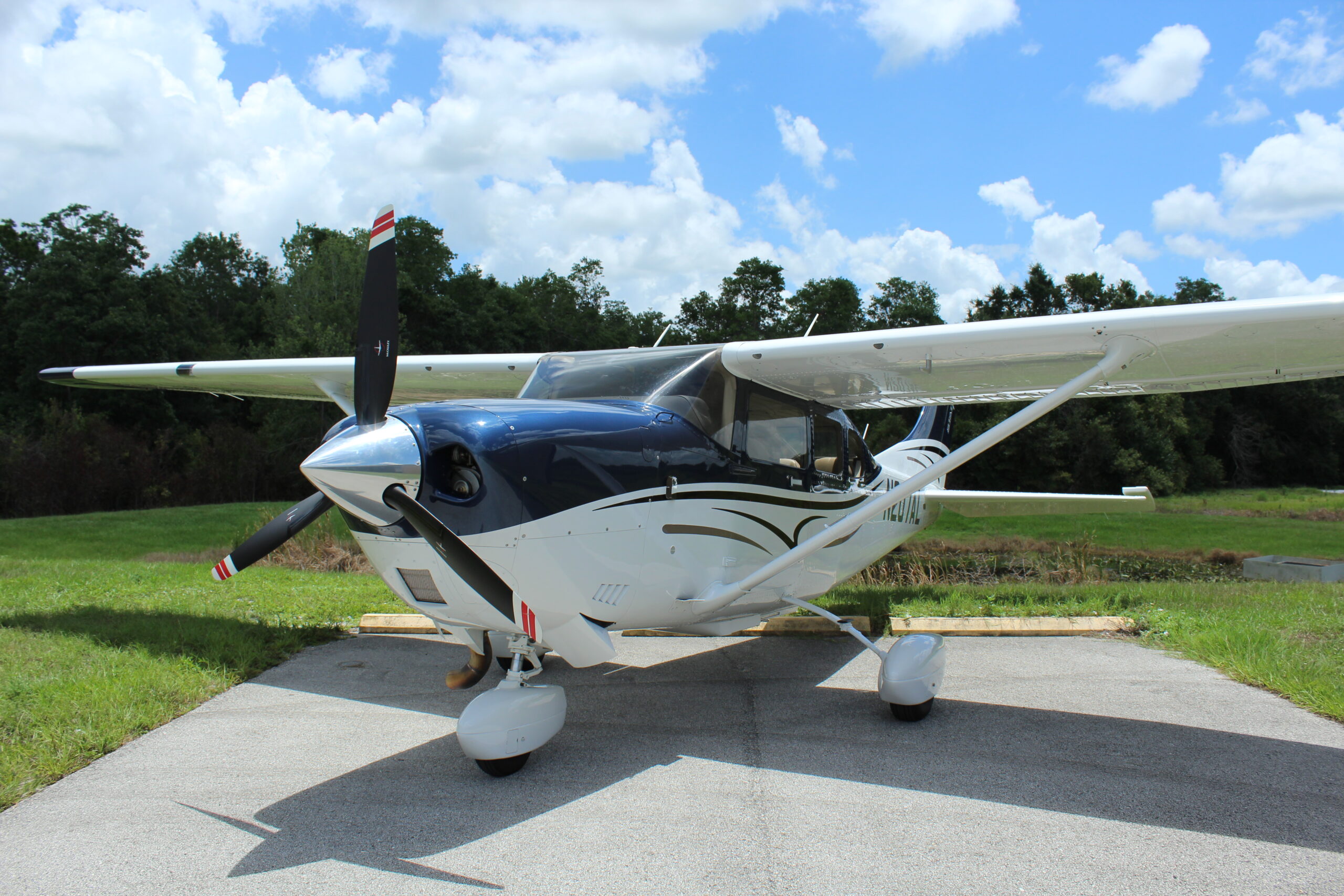
Pickett is pleased to announce that we now have an aircraft stationed out of Greensboro, NC! The aircraft is ready for operation, fully equipped with cameras and a state-of-the-art LiDAR…

Pickett Purchases Optech G2 LiDAR System

Pickett is pleased to announce that we recently purchased the Optech G2 LiDAR system for use in our geospatial department. This cutting-edge new LiDAR system is unique in its versatility…

Pickett Joins Forces with ESP Associates

Pickett and Associates is pleased to announce the combining of Pickett and ESP Associates, Inc. (ESP). ESP, headquartered in Fort Mill, SC., is a top multi-discipline engineering design and consulting…

A Desktop Study – When to Use and Why

Purpose: A desktop study is generally considered to be a preliminary review of readily available and accessible information about a project site to help determine what additional data may be…

Photogrammetry: How it Works and Why it’s Used

Photogrammetry collects measurements and data about an object by scrutinizing the change in position from two different images. It is sometimes referred to as stereo-vision. It uses features like viewpoint,…

GIS: All-Inclusive Communication Tool

As the utility industry adapts to the changing world with amplified project timelines, complex engineering/construction challenges, and scrutiny from the public, it has never been more important to communicate efficiently…

Celebrating International Women’s Day

To celebrate International Women’s Day on March 8th, 2021, we asked our female team members what advice they’d give to younger women who wish to join our industry. Here’s a…

What is Aerial Imagery and Why is it Used?

What is Aerial Imagery? Aerial photography, or imagery, as it is now known, is the method of acquiring images from the air. Vertical photographs are taken with the camera pointing…

What is LiDAR?

Last month, Apple posted a press release on their website announcing the launch of a new iPad Pro, complete with a LiDAR Scanner. We are thrilled that Apple is introducing…

Pickett Adds Additional Florida Office

Pickett is thrilled to report the opening of a brand new office in Pensacola, Florida! This new location will emphasize survey, LiDAR and Geographic Information Systems (GIS) as we continue…

Pickett Opens in Jacksonville

Pickett is pleased to announce the opening of an additional Florida office, this time in Jacksonville! This location will strengthen our relationship with our current Florida clients while extending our…

Pickett Purchases Optech G2 LiDAR System

Pickett is pleased to announce that we recently purchased the Optech G2 LiDAR system for use in our geospatial department. This cutting-edge new LiDAR system is unique in its versatility…

Pickett Expands Substation Offerings

Pickett is excited to announce the addition of a new substation sector, based in Raleigh, North Carolina and operating across the entire company.