
Our aerial platform consists of a 2015 Cessna T-206H Turbo Station Air, modified with FAA approved camera ports for aerial surveys. In addition to topographic mapping and orthorectified imagery, we provide planimetric mapping (mapping of natural and man-made features), impervious surface mapping and traditional photogrammetric mapping. We use fixed-wing aircraft capable of collecting data for wide-area, high-altitude projects, as well as in low-altitude corridors at lower speeds.
Geospatial
We can gather information from virtually every angle.

LiDAR
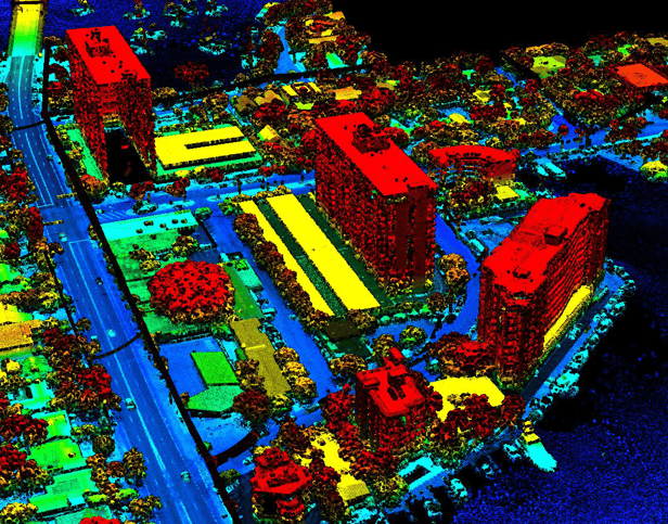
Our airborne LiDAR (light detection and ranging) team focuses on the energy, mining, and land development sectors. We specialize in small to medium-sized projects and can provide anything from raw data to a complete final product. Using data fusion, Pickett can merge results from ground surveys, hydrographic surveys, aerial LiDAR and digital imagery into a complete, all-encompassing map product.
In the energy sector, we can perform aerial surveys of corridors with lengths of 1 mile to several hundred miles, with a point density of 50 points per square meter, or more. For the mining sector, we provide aerial surveys ranging in size from 1-acre stockpiles to several thousand acres, using the data to create digital surfaces and compute high-accuracy volumes for accounting purposes. Land development projects range in size from 20 acres to more than 100 square miles, finalizing into a detailed topographic survey.
The Difference in Our LiDAR Sensor
Check out our sensors capabilities and the efficiencies of Galaxy SwathTrak compared to other sensors.
Aerial Imaging

From golf course communities to small Caribbean islands, our medium-format Phase One cameras can capture your project in great detail. We offer image resolutions from 1 inch to 12 inches to match your project needs. Our cameras are fully integrated with our Optech Galaxy LiDAR sensors, meaning both sensors operate simultaneously, so we reduce costs by capturing both LIDAR and imagery in one flight.
Pickett has been providing professional imaging products to the surveying and mapping community since 1995. Our aircraft is equipped with an advanced digital medium format camera that integrates with the Galaxy system we currently use.
Unmanned Aerial Systems (UAS)
Unmanned Aerial Systems (UAS) is the obvious next-generation solution for mapping and inspecting property and infrastructure. In 2015, Pickett received an FAA Section 333 exemption, and currently complies with FAA Part 107 regulations, to provide UAS services commercially.
Our Unmanned Aerial Vehicles (UAVs) are FAA approved and have been integrated into our business in accordance with current regulations. Pickett currently operates two UAVs – the Skyfish M4 and the DJ Phantom 4 Pro RTK.
Our UAS services include topographic mapping and/or area computations. video inspection, documentation of utilities, construction sites, farmland, and site imaging for insurance purposes. Our UAVs are specifically suited for focused or overall site video and image acquisition.

GIS
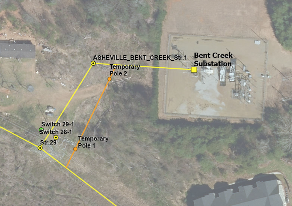
Geographic Information Systems (GIS) offers faster and simpler decision making to meet the demanding needs of major projects from start to finish. Pickett offers the ability to analyze large amounts of data through a geospatial component, which allows our team and clients to simultaneously visualize projects as they progress through time.
The map portal enables our field crew team to take notes in the field and upload data in real-time, meaning our engineering team gets a head start processing field data. Data can then be taken from the portal and inserted into spreadsheets and reports that show project barriers, concerns and suggestions for improvement. This provides complete transparency throughout the project to ensure even the most difficult deadlines are met.