
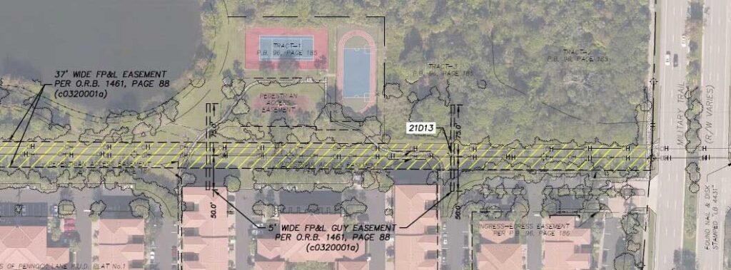
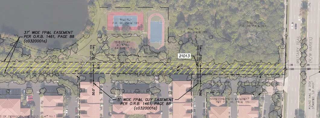
The client desired to replace approximately 20 miles of transmission line between the Hobe and Plumosus Substations. Pickett was tasked with providing the survey data for design and acquiring the easements necessary for the transmission line.
Through aerial and field surveys, Pickett provided the data needed to support the design of the new transmission line, as well as information regarding existing rights of way and easements.
Pickett utilized its fixed wing aircraft, Optech Galaxy PRIME LiDAR sensor, and Phase One iXU-RS 1000 digital camera to capture airborne LiDAR and imagery along the corridor, totaling approximately 20 miles. After post-processing, data calibration, and accuracy verification, Pickett feature-coded the data to client standards and created an ortho-mosaic image. All data was delivered in a PLS-CADD model for use by the engineering team.
Pickett also conducted a ground survey to locate property corners, land corners, and features not visible from the aerial survey. Using a combination of aerial and ground survey, Pickett created a base map in CAD and PDF formats.